 |
| Greenpond GC, former |
Tuesday, October 28, 2008
Greenpond Golf Course
The Golf Course was acquired by Morris County with Green Acres funds a couple of years ago. The county has not decided how it should be utilized yet. The parking lot is open and you can walk around it. I believe that there is a part of this property that goes to Valley road and therefore connects with the Wildcat Ridge WMA.
Norway Park Vicinity
Norway park is a Rockaway Township park on the site of the Nor-Bu Lodge, Lake Telemark ski jump (circa 1948).
 |
| Norway Park |
Rockaway Townships Blazed Trails,10/7/08
NOTE: per a 10/7/08 conversation with Rockaway Parks & Recreation Chief RT does NOT maintain any trails.
1 – MOUNT HOPE HISTORICAL PARK, http://www.morrisparks.net/aspparks/mhmain.asp
Property Owner & Trail Maintainer: Morris County Parks Commission
2 – FARNY HIGHLANDS TRAIL NETWORK, there are several landowners in the Rockaway Township part of this region, e.g., NJ DEP Wildcat Ridge WMA, Farny State Park, access easement from Jersey City, Newark Watershed, Rockaway Township, Morris County Park Commission,
Overview: (http://www.mtnlakes.org/Environment/farny.htm)
Marked up topo map(s):
· Southern End Map
· Middle Map
· Northern End Map
a) Wildcat Ridge WMA Trails in the vicinity of the Hawk Watch - http://f.vanderburgh.home.att.net/imap/wcrtrails.html . The NJ DEP site for this area is @ http://www.state.nj.us/dep/fgw/pdf/wmamaps/wildcat_ridge_so.pdf
- The WHITE Trail is part of the Four Birds Trail and the Blue trail is part of the Split Rock Loop Trail. Both of these trails are maintained by the http://www.nynjtc.org/ and are described in the NJ Walk book published by the NYNJTC.
- The other blazed trails on this map are the YELLOW trail that goes out to Graffiti Rock and the RED, ORANGE & YELLOW trails that in conjunction with the White trail make a loop hike to the Hawk Watch. I do not know who maintains these trails.
- What looks like black trails are woods roads & are unblazed.
b) Trails in the vicinity of Splitrock Reservoir - http://f.vanderburgh.home.att.net/imap2/sr-trails.html
- The WHITE & BLUE trails are parts of the Four Birds Trail and the Split Rock Loop Trail.
- There are several BLAZED Trails covered by this map not shown on the map:
1 - There is a YELLOW connector trail from the parking area in Farny State Park on Timberbrook road that goes to the Four Birds Trail. It is west of and parallel to Timberbrook road.
2 - The Four Birds trails has a bypass for its portion that goes over the Timberbrook Lake dam. It uses Timberbrook road north to the Wharton & Northern rail bed and then west to where the Four Birds Trail crosses the W&N.
3 – Winnebago road is blazed red from the Scout Reservation to Misty Pond. The scout reservation does not want hikers using its property.
4 – There is a LAVENDER blazed trail west of the Four Birds trail that goes from Splitrock road to Camp Marcella or Winnebago. There is a connector trail (YELLOW) off of it to Camp Lewis. The Camp Lewis trail, my guess would have been done by them. The Lavender trail, my guess would have been done by both BSA camps. When on the Lavender trail you do not see white blazes and when on the white trail you do not see lavender blazes. There are several spots where there are woods roads that can be used to go from one trail to another to make loop hikes.
3 – Miscellaneous
a) White blazed trail at Craigmeur (http://www.craigmeur.com/ ). It uses part of a woods road that goes to Notch road & the Four Birds Trail. It is blazed from the water slide to the stream. Blazed & maintained by Craigmeur. This would make a good additional trail head to access the Greenpond Mountain part of the Four Birds trail.
b) RED blazed trail that starts on Snake Hill road just west of Lake Ames parking area. This trail follows Hibernia brook until it leaves the woods road & goes to a private house south of Lake Telemark. Unknown origin.
c) White Blazed trail from the former site of the Hudsonia Girl Scout Camp to the Lake Telemark – Oreland junction woods road. This trail is being worked on but the blazing is ancient. Unknown origin.
Tuesday, July 8, 2008
Independence Day weekend 2008
The Ford-Faesch house was open for visitors this past Independence Day weekend. To learn more about the Ford-Faesch house visit the "Historical Society of the Rockaways" web site @ http://historic-rockaways.org/faesch.htm
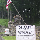 |
| Ford-Faesc |
The next time the Ford-Faesch house is scheduled to be open to visitors is 23 August 2008. This is the same day as Wharton's Canal day festival. If you are attending that then you can take a free bus, provided by Morris County to Mt Hope. The county will have the Mt Hope Methodist Church open for visitors and the Ford-Faesch house is directly across the street.

Monday, June 23, 2008
Easy Diggin Day @ Mt Hope Quarry
June 21,22 the NJ Chapter of Easy Diggin had an open house at Tilcon's Mt Hope Quarry. This is the site of the historic Mt Hope (New Leonard mine) complex. This was the deepest iron mine shaft in the US. In the 1970s it was considered for pumped storage facility for electricity; in times of high electricity demand the mine shafts would be flooded to generate electricity and when demand was low the water would be pumped out of the mine into Mt hope lake. One of the environmental impediments for this project where the unique habitat for mute swans - see the photo.
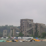 |
| easy diggin day 2008 |
Sunday, May 25, 2008
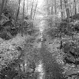
Snake Hill Road loop
This walk is a loop trail that begins and ends on Snake Hill road. A good place to park is Lake Ames also called the RT Castle Playground. The trail meets snake hill road about 100' West of the bridge on Snake Hill road and again about 1 mile further west. The trail is about 3 miles long. If you start at the Lake Ames end just follow the woods road left. It begins as a red blazed trail whcih early on crosses Hibernia brook (a stream that feeds Lake Ames) and the back again. If you do not like to cross streams just bushwhack until the trail returns. Later on there a three side trails on the right including the Red Blazed trail- ignore these and just bear left. On this walk you will pass the DENMARK mine.
 |
| Snakehill road loop |
Friday, May 23, 2008
Oreland Junction of the W&N RR
Today I went looking for Oreland Junction of the W&N. This is where the Oreland Branch met the mainline of the W&N. What I called the control tower in the phootos is located between the mainline & Oreland Branch on a high spot. The other foundation is off of the connector road between Valley road (LAND TRUST sign) and the W&N RR ROW.
Photos href="http://s86.photobucket.com/albums/k115/jsovelove/081022%20UCHC%20Oreland%20RR%20Bed/
a friend took on a hike I led on the Oreland RR bed from Upper Hibernia road. Of interest is the OWL.
 |
| Oreland Junction area |
Photos href="http://s86.photobucket.com/albums/k115/jsovelove/081022%20UCHC%20Oreland%20RR%20Bed/
a friend took on a hike I led on the Oreland RR bed from Upper Hibernia road. Of interest is the OWL.
Wednesday, May 21, 2008
Jacobs road access to the 4-birds trail
Today I scouted a hike to be led for UCHC on 5/29/08 from Jacobs road to the high point of Copperas Mountain. I parked by Timberbrook lake and took the Wharton & Northern RR ROW to the white blazed 4-birds trail. I then took the 4-birds trail to the top of the mountain. Near where the trail turns down to Greenpond road there is an open ledge with a terrific view of Charlotteburg reservoir and the surrounding hills. I then turned around and came back the same way. This walk takes about 3 hours round trip.
 |
| Copperas mtn |
Monday, May 19, 2008
Exploring the W&N RR ROW - Jacobs road west
Today I explored the Wharton & Northern RR abandoned right of way from Jacobs road to Greenpond road. It is rather pretty with swamps, wetlands and rock cuts - it is about 1 mile. The ROW is blocked in several places but there are alternate routes used by ATVer's. After coming to the house I back tracked a fork in the trail and went the other way. After awhile I came to a wet area and took another fork in the road. I only explored one of the covered landfill areas - this was Rockaway Townships town dump for many years. Before it was a dump it was a mining area, Green mines I believe. I did not try and find any signs of this.
 It is rather pretty with swamps, wetlands and rock cuts - it is about 1 mile. The ROW is blocked in several places but there are alternate routes used by ATVer's. After coming to the house I back tracked a fork in the trail and went the other way. After awhile I came to a wet area and took another fork in the road. I only explored one of the covered landfill areas - this was Rockaway Townships town dump for many years. Before it was a dump it was a mining area, Green mines I believe. I did not try and find any signs of this.
 |
| scouting the W&N |
Saturday, May 17, 2008
Guide Book: The following section is planned to be a comprehensive list of resources. It is a work in progress.
How to get to Rockaway Township:
- RT is in the center of NJ off of I-80 exit 37.
BRIEF (very) history of Rockaway Township:
The official town page is @ http://www.rockawaytownship.org/ . The townships history has been greatly influenced by mining and particularly iron mining. Please note that around 1894 (I'll check this out) what is today called Rockaway Borough seceded from the township. John Jacob Faesch (brought to Rockaway by Col Jacob Ford during the war of independence) was the first notable ironmaster and Joseph Wharton (a founder of Bethlehem Steel) was the last.
- Before the railroads and the Morris Canal: "The Hibernia Mine was first worked as early as 1722 first as the "Adventure Furnace" and later as the Hibernia Fumace. It supplied shot and ordnance for the Continental Army during the Revolutionary War", from "Protected at Last: The Hibernia Mine" by RICK DUTKO on the web @ http://www.batcon.org/batsmag/v12n3-1.html . In 1772 Ford built the Ford-Faesch house to lure Faesch to Rockaway. The "Historical Society of the Rockaways" @ http://historic-rockaways.org/faesch.htm is the process of restoring this house. Several times a year the house is open to the public.

Ford-Faesc h House - The railroad and Morris Canal age: This web site http://en.wikipedia.org/wiki/High_Bridge_Branch has a railroad map that includes Rockaway. "Shortly after 1867 the Hibernia Railroad, which was built during the war; civil from Hibernia to the Morris Canal at Rockaway as a horse road, was extended to the Morris and Essex line and made a steam road. It is a separate corporation in every respect, the Morris and Essex not owning or controlling its stock. The Mount Hope Railroad, from Port Oram (Wharton) via the Richards, Allen and Teabo mines to Mount Hope, was built just after the war;civil , to carry the immense ore freights of these mines along its route. It supplanted in use a tram railway from Mount Hope to the canal at Rockaway", ref http://www.rootsweb.ancestry.com/~njmorris/munsellhistory/h-chpt11.htm . This web site http://www.rootsweb.ancestry.com/~njmorris/maps/1887mcpg38.gif is a map that shows how the railroads met up with the Morris canal in what is now Rockaway Borough - there is the remains of a lock at the borough police station on Maple avenue. Excerpts fom the Arcadia book on the canal can be viewed on Google books @ http://books.google.com/books?id=1odavP8nKhYC&pg=PA76&lpg=PA76&dq=morris+canal+dover&source=web&ots=ndmxXI8J2r&sig=dakI1xA1PMML2yRW0J9MB8Vyxs8&hl=en#PPP1,M1 . The NJ Canal Society web site is @ http://www.canalsocietynj.org/ .
- After the railroad and Morris Canal: A history of the mines including a paragraph on the "Decline of the Iron Industry" is summarized on this web site http://www.rtlibrary.org/history.html#furnaces . In 1916 Replogle bought the Wharton Steel Comapany from the Wharton estate - see NY Times article @http://query.nytimes.com/mem/archive-free/pdf?res=9E02E0DC1430E733A05752C0A9679D946796D6CF
Open Spaces with Public Access:
- Rockaway Township: The township map showing township recreational facilities http://www.rockawaytownship.org/parks/images/recreation_facilities.pdf . There is parking at Lake Ames, Mount Hope Pond, Egbert Lake (this area is open since Oct07), and Hudsonia field from which walks of exploration can be accessed. These locations and others are briefly described on this web page http://www.rockawaytownship.org/rec_outdoors.html .
- County: Parks & undeveloped Morris County Park commission property
- The State of New Jersey: Parks, WMA
- Non Governmental Organizations: conservation org, newark watershed, jersey city watershed
SERVICES: There are limited services on Greenpond road. Near I-80 there are two gas stations and the Hibernia Diner. Going north 1.7 miles just before Meridan road (140 GREENPOND ROAD) is a Gulf Gas Station and a Bagel/Deli store (closes about 2PM) next to a CLEANERS. Another 2.2 miles up the road is the Hibernia Tavern & Pizzeria and across the street from this is the Grab and Run Deli. Thats it.
draft, to be improved - Wildcat Ridge WMA (Wildlife Management Area) is administered by the NJ DEP, http://www.njfishandwildlife.com/wldcthwk.htm . It is located in the southern end of Rockaway Township off of route 513 (Greenpond road). Farny State Park (undeveloped) and the Splitrock Reservoir area are contiguous with Wildcat Ridge WMA and also have public access. In addition to the state web site for Wildcat Ridge WMA there is an enhanced web site, http://f.vanderburgh.home.att.net/ , which provides additional information.
ACTIVITIES @ Wildcat Ridge WMA
Hunting
Hiking
Mountain biking
Hawk watch
Bat cave
POINTS OF INTEREST
This WMA was an iron mining area and was the site of the Hibernia mines, Beach Glen mines and the Oreland (Upper Hibernia mine). All of the mine shaft openings have been closed off for the safety of the public. There various ruins at each of the mine sites. In addition to these railroad era mines there is the site of a pre-railroad mine the Adventure/Hibernia Furnace which was located approximately across Hibernia brook from the current Hibernia Firehouse. This is also the site of many ruins of the Hibernia mine. I have not found any evidence of the Adventure furnace. For additional information on the mines visit history web site & mine web site.
1- Bat cave – this was the Hibernia mine tunnel where the underground railroad was located.
2- Hawk watch
3- Oreland spur of the Wharton and Northern railroad. Ref????
PARKING
There are numerous parking areas for this area.
1- 2.7 miles north of I-80 is a parking area (marked with a NJ brown NJ DEP sign) where the Four Birds hiking trail begins. This the site of the Hibernia mines and ruins adjoin the parking area.
2- Parking for the Upper Hibernia/Oreland area and the Wildcat Ridge hawk watch area is along Upper Hibernia road. To get there take Greenpond road north from I-80 for 6.1 miles and make a right @ the Marcella Firehouse sign, and go past the Marcella Firehouse. You will come to a “T” in the road, left is Splitrock road and goes to the Splitrock Reservoir dam and parking area, straight ahead ("NO OUTLET" sign) is Upper Hibernia road. There is a parking area under the power transmission lines, there is a parking area just after the pavement ends (Oreland area) and there is a third parking around just before the road is blockaded for the Hawk Watch.
3- There are also pullouts on roads that boarder the WMA. One is on Meridan road opposite the service gate of the Christ Church (formerly HP) property. This provides easy access to the Beach Glen mine area. Another is on Greenpond road just before the left for Lake Denmark road. This where the Oreland spur of the Wharton and Northern crossed Greenpond road.
Subscribe to:
Posts (Atom)